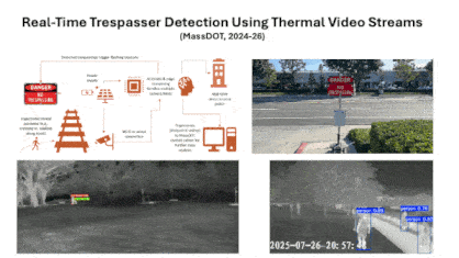
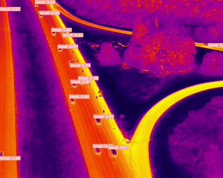
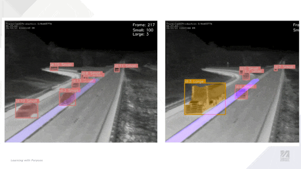
Edge AI-Based Railroad Trespassing Detection and Warning System
This project utilizes thermal cameras and Edge AI to create an affordable detection and warning system. The system’s key components include dynamic warning signs, real-time video processing, and automated trespassing detection at the edge. This off-grid, solar-powered system detects trespassing and transmits data to the cloud intermittently, lowering communication costs. (2024-2027)
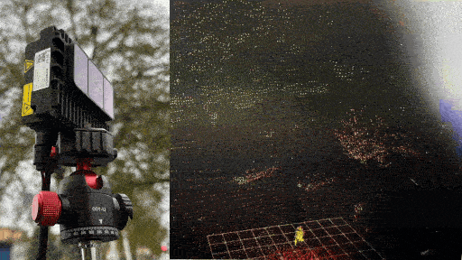
BENTO: Bundled Environmental & Navigation Traffic Observer Github
Compact, portable sensing unit combining LiDAR and RGB or thermal camera on a small-footprint SBC-based platform. Designed for traffic and road-user observation in constrained environments with rapid deployment capabilities.
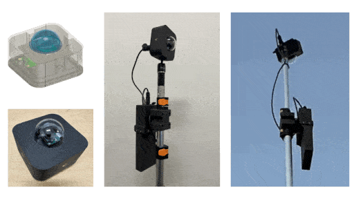
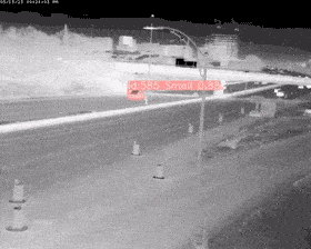
Low-Light All-Weather Traffic Camera
Designed for outdoor environments, this camera can operate in rain, snow, and extreme temperatures while capturing video efficiently over extended periods. The system is optimized for low power consumption, automatic file management, and reliable performance in challenging lighting conditions. Whether for wildlife monitoring, security, or time-lapse photography, this project offers a compact and cost-effective solution. ASSET, MassDOT (2025-27).

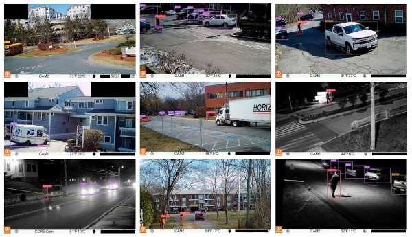
Efficient Edge Learning for Thermal Vision
We present a lightweight, submodular active learning framework for improving person detection models on edge devices by identifying and incorporating uncertain or underrepresented instances from deployment environments. The system enables periodic model refinement through selective sampling, clustering, and distillation, enhancing robustness to diverse and location-specific conditions with minimal supervision. NEITS Annual Interchange, 2025
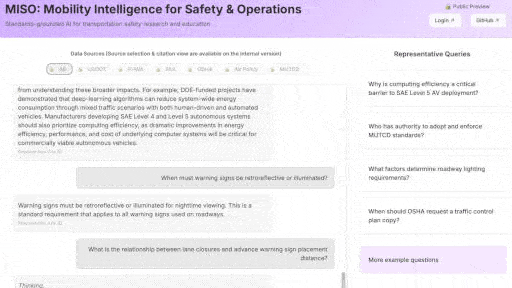
MISO: Mobility Intelligence for Safety & Operations (RAG LLM) Github 🔗 URL
MISO is a standards-focused, retrieval-augmented intelligence platform designed to support transportation engineering, traffic operations, safety analysis, and mobility research through structured and explainable querying of authoritative technical documents. (2025-26)
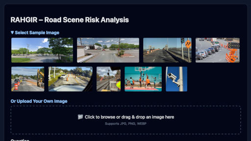
RAHGIR VLM: Road-scene Analysis for Hazards with Grounded Interactive Risk Reasoning Github
RAHGIR is a policy-conditioned, domain-specialized vision–language reasoning system designed to analyze forward-facing ego-vehicle road scenes and produce structured, probabilistic assessments of traffic risk under partial observability. (2025-26)
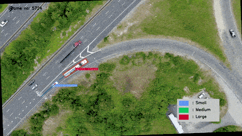
Smart Work Zone Control and Performance Evaluation Based on Trajectory Data - Thermal UAV Video Data Github
Thermal imaging analysis solution aimed at vehicle tracking in drone-captured videos, incorporating oriented bounding boxes and SHAI for superior detection capabilities. (2022 - 2024)
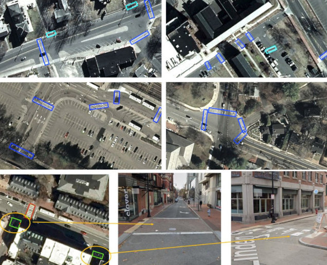
CrosswalkNet: A deep learning framework for pedestrian crosswalk detection Github
CrosswalkNet is a deep learning framework optimized for detecting crosswalks in aerial images across over 10,000 square miles. It utilizes high-resolution aerial imagery from MassGIS captured with an UltraCam Eagle M3 camera.
Towards Safer Highway Work Zones: Insights from Deep Learning Analysis of Thermal Footage Github
This research project aims to develop methods to extract vehicle trajectories, use the trajectories to analyze driver behavior, particularly lane-changing behavior under different conditions, and identify safety hazards and opportunities to improve work zone safety and operations. (MassDOT Research Program with funding from FHWA SPR funds.) Research in Progress-Record
Transportation Data Analytics and Pilot Case Studies Using Deep Learning Github
Current Status of Transportation Data Analytics and Pilot Case Studies Using Artificial Intelligence." sponsored by the New England Transportation Consortium (NETC) Project Webpage
Uncovering the Root Causes of Truck Rollover Crashes on Highway Ramps Github
Vehicle detection using modified Mask-RCNN: Oriented Bounding Box (OBB) + instance segmentation. Download Technical Report
Massachusetts-Specific Trip Generation Models for Land Use Projects Github
The primary focus is on utilizing location-based service (LBS) data to create accurate and efficient trip generation models, particularly for urban sites that benefit from proximity to public transportation. Download Technical Report